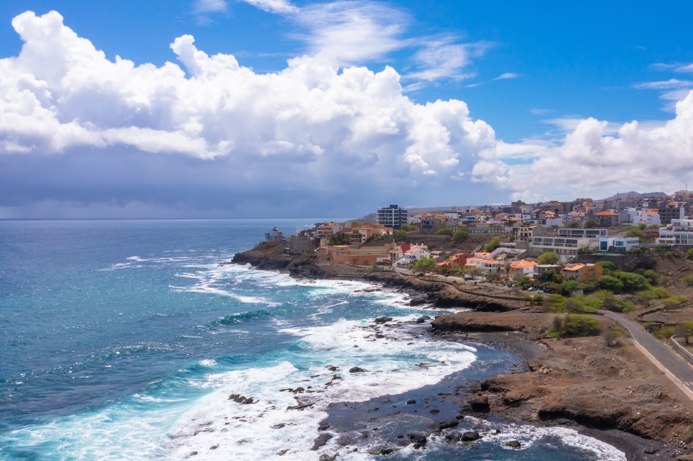
Santo Antão
The archipelago's verdant island, reached by ferry from Mindelo, crossed by ancient cobbled paths linking the Cova crater to coastal villages in the north.
Santo Antão is the second-largest island of the archipelago by area and the northernmost of the Barlavento group. It's reached from Mindelo, on São Vicente, by a daily hour-long ferry that deposits travellers at Porto Novo, on the drier south coast. It's by crossing the central mountain chain—either via the historic cobbled Corda road or the newer asphalt route through the Delgadinho pass—that one enters the north-facing slope, humid and lush.
This contrast between the two slopes structures the entire rhythm of island life. To the south, the landscape recalls a mineral desert, dotted with cassava and sweet potato cultivation. To the north and east, the trade winds hit the ridges and trigger a microclimate that feeds the valleys of Paúl, Ribeira Grande, and Ribeira da Garça. Here you'll find terrace-grown sugarcane, altitude-grown coffee around Cabo da Ribeira, banana and mango trees, maize, and beans. This subsistence agriculture remains largely manual, organized around small family plots clinging to vertiginous slopes.
The island's heart is occupied by Cova de Paúl, a former volcanic crater around 1,500 metres in altitude, transformed into a patchwork of cultivated fields. On clear days, from the crater's edge, you can see the ocean on both sides. This is where several of the archipelago's most well-marked trails begin, including the classic descent to Ponta do Sol through Ribeira do Paúl valley, which takes roughly five hours of walking on paths cobbled during the colonial era. These caminhos once connected hamlets before the arrival of motorable tracks and now form the primary network for those crossing the island on foot.
Each of the northern towns has its own character. Ribeira Grande, the former administrative capital, retains some colonial façades and a lively morning market. Ponta do Sol, further west, is a former port with low, painted houses where fishing boats can still be seen returning late morning with tuna and grouper. Further east, towards Cruzinha da Garça, you enter a less-visited, more rural zone where hamlets dot the hillsides above nearly inaccessible coves.
Local culture revolves around grogue production, a sugarcane spirit distilled in trapiches, traditional stills powered by animal traction or motor. At Paúl, several family-run distilleries around Vinha and Cabo da Ribeira welcome visitors. You can also taste ponche, a grogue syrup flavored with sugarcane honey, tamarind, or lemon. Culinarily, cachupa—a stew of maize, beans, and meat or fish—takes on a distinctly agricultural dimension here, featuring root vegetables grown locally. The everyday language is Santo Antão Creole, which differs markedly from that spoken on Santiago.
The island has no operational airport. Everything passes through Mindelo and the ferry, making it a stop that must be planned within an archipelago itinerary. This logistical constraint has also protected Santo Antão from mass tourism development. People come here to walk, to understand tropical mountain agriculture, and to traverse, over a few days, landscapes that change radically every twenty kilometres.
To discover
Descent from Cova to Ponta do Sol. Five hours of walking from the crater's edge to the sea, along ancient cobbled paths crossing the terraced hamlets of Paúl valley, among sugarcane and banana groves.
Grogue distilleries at Paúl. Visit to trapiches around Vinha and Cabo da Ribeira, where sugarcane is pressed and then distilled in copper stills, with tastings of ponche flavored with sugarcane honey.
Coastal trail from Ponta do Sol to Cruzinha. Six to seven hours along cliffs above the Atlantic, passing through Fontainhas, a village perched on a rocky spur photographed from the trail.
Ribeira da Torre valley. Deep valley behind Ribeira Grande, a day's hike through terraces irrigated by levadas, leading to hamlets Lombo de Pico and Boca de Coruja.
Corda road. Historic cobbled route crossing the island from south to north at 1,300 metres, with dramatic vegetation changes across fifty kilometres.
When to go
Santo Antão can be visited year-round, though conditions vary markedly with altitude and aspect. The most comfortable season for hiking runs from November to June, with temperatures between 20 and 26 degrees on the north coast and 12 to 18 degrees at Cova's heights in the morning. Trade winds blow strong from January to March, making ridges occasionally windy but keeping the air clear.
From late July to October comes the rainy season, locally called das águas. Showers mainly affect the north and east slopes, often in late afternoon, and can make some cobbled paths slippery or temporarily cut tracks with rockfall. This is, however, when the valleys are greenest and agriculture at its most active. The south slope around Porto Novo stays dry almost year-round. August and September see the heaviest rainfall, best avoided for strenuous hiking programmes.
Practical advice
We recommend a minimum of four days on the island to justify the ferry crossing and link two or three major trails. Five to six days allow you to include the north-east coast to Cruzinha and a more contemplative day in Paúl valley around the distilleries. Beyond a week, you enter serious-hiking territory suited to experienced walkers. Access is exclusively by ferry from Mindelo, requiring you to combine Santo Antão with São Vicente, with at least one night in Mindelo on either end of your stay.
The most coherent combination pairs Santo Antão and São Vicente on the northern branch, then Santiago for historical immersion around Cidade Velha, and Fogo for its volcano and wines from Chã das Caldeiras. The islands of Sal and Boa Vista, more beach-focused, can be added at the end for those wanting to finish by the shore. Accommodation on Santo Antão consists of family pensions and a few small hotels in Ponta do Sol, Ribeira Grande, and Paúl valley, with simple yet thoughtful comfort. The island suits hikers particularly well, those curious about agriculture and landscapes, and couples seeking a rural stop between more urban islands. It's less ideal for very young children given the constant elevation changes.