Pico do Fogo
Pico do Fogo
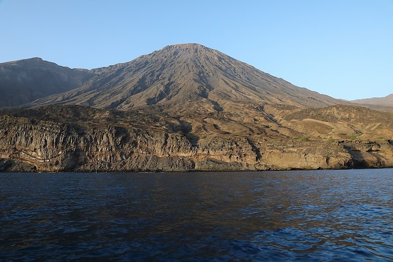
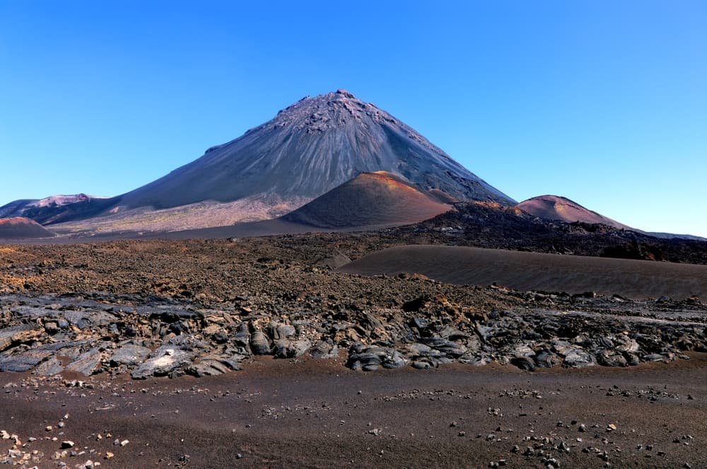
At 2,829 m, Pico do Fogo is Cape Verde's highest peak and one of the Atlantic's most impressive active volcanoes. A demanding ascent, a inhabited caldera, and black lava landscapes make this island a unique experience.
Pico do Fogo is Cape Verde's highest point at 2,829 meters, located on the island of Fogo. This active stratovolcano—whose last eruption dates back to 2014-2015—dominates a spectacular caldera inhabited by a few hundred villagers. The demanding ascent rewards climbers with panoramic views of the Atlantic and neighboring islands. It is one of the most active volcanoes in the Atlantic.
Quick Practical Info
- Access: from São Filipe, Fogo's capital, by taxi or rental car to the village of Chã das Caldeiras, inside the caldera.
- Mandatory guide: climbing to the summit requires an approved local guide—mandatory for safety reasons.
- Recommended duration: plan 4 to 6 hours round trip for the complete ascent from Chã das Caldeiras.
- Difficulty level: challenging hike—unstable volcanic terrain, significant elevation gain, no infrastructure along the route.
- What to wear: hiking boots essential, warm clothing (summit temperature significantly lower than base), plenty of water.
- Natural park: Pico do Fogo is included in Fogo Natural Park—entry may be required.
What You'll See
The Chã das Caldeiras caldera, approximately 9 kilometers wide, forms the immediate backdrop for the climb. The black lava flows from 2014-2015 covered parts of the villages of Portela and Bangaeira. The resulting landscape—submerged homes, vineyards replanted on lava—is striking. The summit cone, formed during a recent eruption, offers 360° views on clear days.
History and Context
Fogo, whose name means "fire" in Portuguese, owes everything to its volcano. Colonized in the 15th century, the island has experienced numerous documented eruptions. The 1995 eruption had already forced evacuation of the caldera. The November 2014 eruption, the most destructive in decades, lasted several months and destroyed most homes in Chã das Caldeiras. Residents returned and rebuilt, replanting vineyards and coffee trees on cooled lava.
Highlights of Your Visit
Climbing the Summit Cone
The trail departs from Chã das Caldeiras and climbs across ash and volcanic rock. Progress is physically demanding: loose soil slows every step. At the summit, on clear days, you can see the islands of Santiago and Brava.
The Village of Chã das Caldeiras
Living inside an active volcano: this is the daily reality for Chã das Caldeiras residents. A few guesthouses, a wine cooperative, and coffee producers welcome visitors. Fogo wine, produced on volcanic soil, is recognized throughout the archipelago.
The 2014 Lava Flows
Traces of the eruption remain visible: frozen lava walls, rooftops of former homes barely showing above the surface. A walk around the flows, without a guide, is accessible from the village.
Photography Tips
Morning light is ideal before clouds accumulate around the summit. The contrast between black lava, green vineyards, and blue sky is particularly striking during the dry season (November to July). From the caldera's edge, the cone photographs well in late afternoon with raking light.
Location and Access
The island of Fogo is accessible from Praia (Santiago) or Sal by domestic flight, or by ferry from Santiago. São Filipe, the island's capital, is the departure point for reaching the caldera. The road up to Chã das Caldeiras is asphalt but winding. Local guides offer climbs from the village; your Nomadays team can arrange transport and a guide.
Nearby
- São Filipe — colonial capital of Fogo, with its sobrados (two-story Creole houses) and bustling market.
- Island of Brava — the smallest inhabited island of the archipelago, accessible by ferry from Fogo, known for its flowers and tranquility.
- Chã das Caldeiras Wine Cooperative — tasting volcanic wine produced inside the caldera itself.
Frequently asked questions
Yes, an approved local guide is mandatory for summit ascent. Unstable volcanic terrain and lack of clear markings make the climb dangerous without accompaniment.
The dry season, November to July, offers the best conditions: clear skies and maximum summit visibility. During the rainy season (August-October), clouds frequently cover the cone.
Yes, several small guesthouses and rooms with locals welcome visitors in the caldera. Sleeping on-site allows for an early morning start, before clouds arrive.
Pico do Fogo is an active volcano. Outside of eruption periods, visiting is permitted. Park authorities monitor seismic activity and can close access if necessary.
Plan 4 to 6 hours round trip from Chã das Caldeiras, depending on your fitness level. Descent on volcanic ash is quick but hard on the knees.
Yes. A ferry regularly connects Fogo to Brava. Plan at least two nights on Fogo for the climb, then an additional day to reach Brava.
Interested in this visit?
We can include it in your personalised itinerary.